The Suunto app has received various improvements that will improve your training considerably. Here are the essential things you can do, and you need to know about to benefit from its development.
Keywords:
Popular starting point - while you check out the heatmap, you will come across several frequented spots by our community to start their training.
Popular routes - select an area on the map and search for the most frequented routes our community members are also using in their training.
Route - is the path you created or decided to take from point A (the starting point or the popular starting point you just saw) to point B (the endpoint).
Waypoint - is an easy way to guide yourself with your Suunto watch.
POI (point of interest) is another way to mark a special place on a map or navigate a specific location.
.gpx - just in case you already found a track you want to follow and you don't know how to add it to the Suunto app or export it from the Suunto app and use it with another service.
Check out the best places for your activities:
Regardless of where you are and your plan, take your phone out and use the Suunto app to find the best routes for your next adventure. You can either tap the map preview on the home view of the Suunto app or the map icon in the access bar. Both will open up a map with the following options:
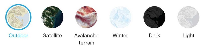
- Map style/ map type: select the map type you need. It highlights the details you are interested in.
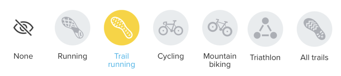
- Heatmap: offers you an indication of the most frequented training spots per sport. Select the activity type for your heatmap and see where others are training.
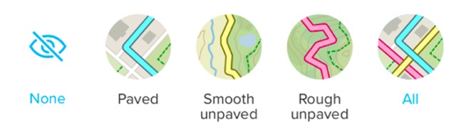
- Road surface: adds a layer to the map allowing you to choose what type of surface you need for your training or adventure. You can select and highlight multiple surface types at the same time depending on your needs
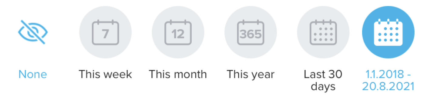
- My tracks: show the tracks you have covered this week, month, this year in the last 30 days or a custom period. You can view your tracks on any map type.
Find out where to get going from on your new adventure:
According to your location, the Suunto app will also show you the area's popular routes and popular starting points. You can select the sport you are interested in routes for and go through all of the ones available in the area of your search.
Tap on any of the popular routes, rename it so it's easier to identify it, edit the suitable activity type (optional) and Save it to your route gallery and sync it to your watch.
Add more details to your route:
You can add waypoints to your route and rename them to reflect the pit stops you are interested in. Tap and hold on a specific place along your way to add a waypoint.
Select Turn-by-turn navigation on any route you created to get notifications on your watch and know which way to go.
Select the 3D option to plan your routes even better. In the mountains or out on the trails, the 3D map view will offer more insight into the terrain and will help you tackle all those ups and downs.

Create, import, and export routes for your training.
After you have checked out where other people are training and you know where you want to go, you can create your route or import it (.gpx format). Create a route in the Suunto app for iOS/Android and learn how to import a .gpx file to the app for iOS/Android.
- You can use the data in the Suunto app with our partners and other 3rd party platforms.
You can export both the .gpx file (1) and the .fit file (2) of your training from the Suunto app.
- Open your saved routes gallery and tap the Share button. Send the .gpx file to a friend, AirDrop it, save it to your Files or Google Drive. Additionally, you can go to your exercise, tap the "More" (three dots), and save the route to the gallery.
- Open any training you recorded, tap the "More" icon, and select to export as .FIT file. Send the .FIT file to a friend, AirDrop it, or save it to your Files or Google Drive.
- You can manage the routes you saved and share them with your training buddies.
You can always double-check and manage the available routes you have, including searching for them by name, filtering by distance or sorting them according to your preferred method; you can share them if you and your buddies want to train on the same trail. It also helps our community by creating valuable recommendations for other Suunto users.
Your route gallery on iOS and Android (see more about the route library and managing your routes on iOS and Android):
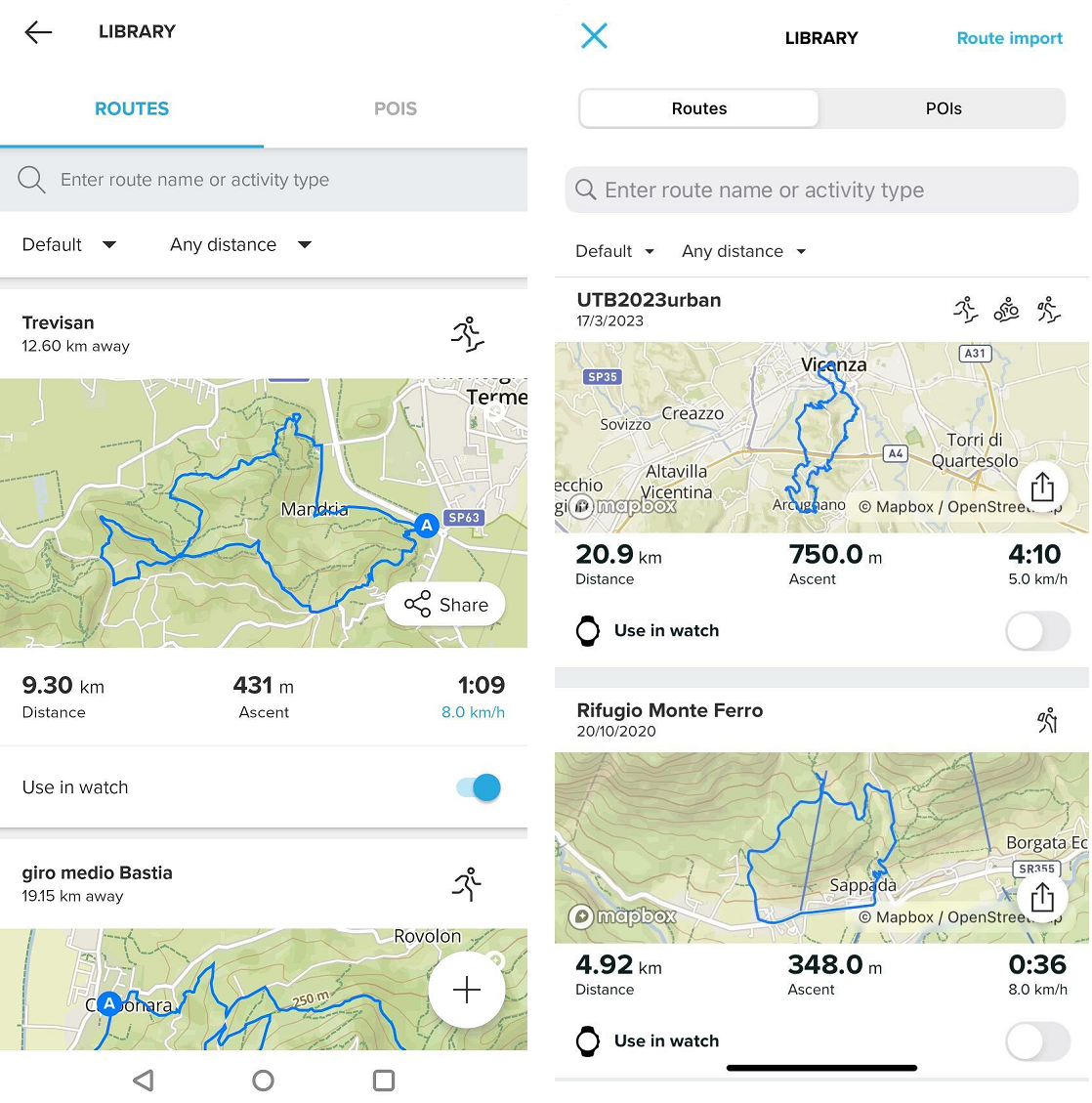
To remove a route from your watch, find it in the route library and un-toggle the "use in watch" option. The route will still be stored in your route library, and you can activate it again by using the toggle again. To delete the route completely, open it and select the delete option (trash can icon on Android, three dots and then "delete" on iOS).
See more on how to manage your routes in the route library on Android/iOS.
- You can always give kudos to your friends, save their routes and engage with our community.
You can save a route from a friend’s workout or a public workout in your area: open the workout and tap on the three dots on the top right. Select “Save route” and the route will be saved in your route library. Don't forget to show some support and give them a shout-out.![]()
Note: Make sure you have synchronized your watch with the Suunto app after making all the changes; otherwise, they will not reflect in the watch.